


Description
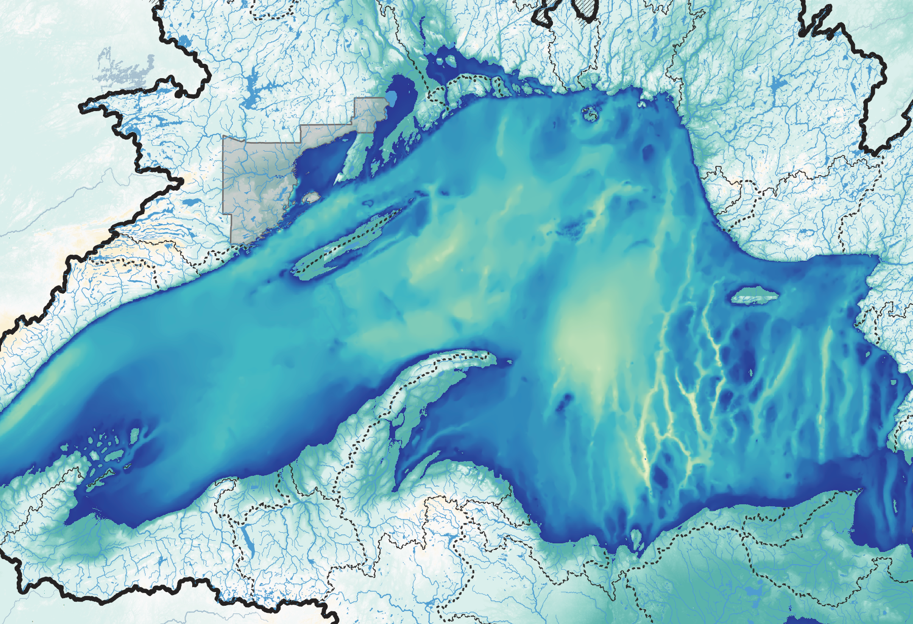
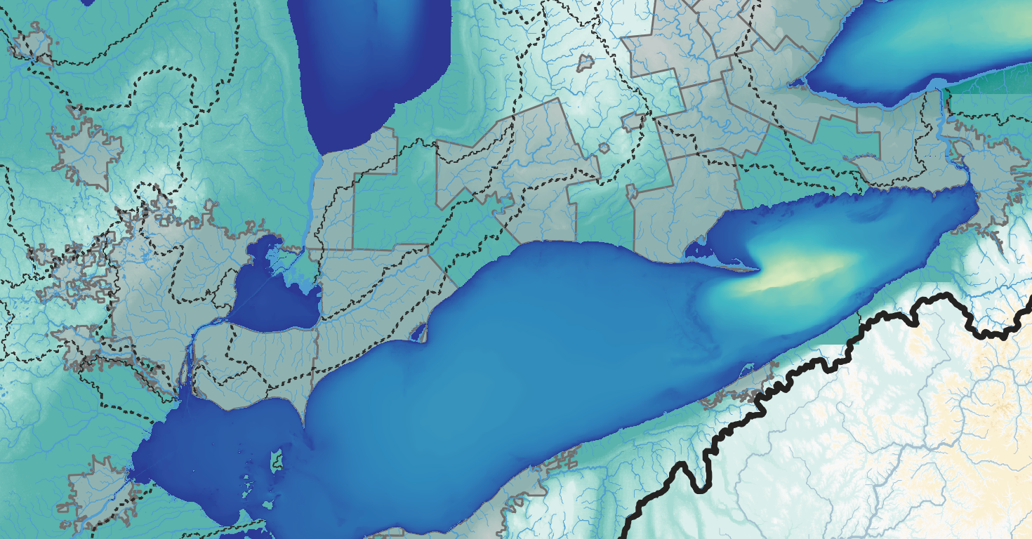
This map shows the entire watershed of the Great Lakes and St. Lawrence Seaway and includes physical terrain for the land and bathymetric coloring for the lakes (including Lake St. Clair). Overlaid on that is every river, stream, and lake with an area larger than 10 acres within the watershed, and all urban areas with a population greater than 100 thousand. Major rivers and lakes outside the watershed but within the map boundary are also drawn. Finally, the map shows the boundaries for all sub-basins within the two respective major watersheds. The map is set to a 1:5,000,000 scale, so one inch on the map equals about 79 miles.
Data for this map came from several public and non-profit sources. Watershed boundaries, rivers, and lakes are from the HydroSHEDs project for completeness and consistency across the US and Canada. This means boundaries naturally differ from the authoritative sources provided by state, local, and national governments. Similarly, the bathymetric data for all the lakes except Huron comes from the National Oceanic and Atmospheric Administration (NOAA). Huron’s data comes from GEBCO.
This map will also be available as a print, but you can also buy this digital copy if you want to print it yourself.
Reviews
There are no reviews yet.